See what we have been up to this year.
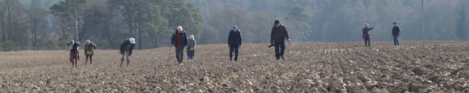
We have been out fieldwalking since the start of the year and been been successful in finding more worked stone tools.
Click HERE (opens ArchGIS - takes up to a minute to load)
to open up a web map that will show the location of all our finds for this year. You can scroll around and zoom in. Click on any of the symbols to get more information about the individual finds.
Mapping Mesolithic Deeside
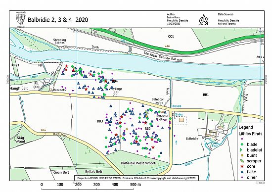
Mesolithic Deeside volunteer Irvine Ross has been working on scatter plots of the finds so far including those of people collecting flints around the Dee over the last few decades to flints recovered during last winter's fieldwalking. He will be adding flints as we find them.
If you know of any collections that we do not know about or are not on these maps then please let us know.
You can read a summary report on all the lithics collected by fieldwalking in Deeside to date HERE
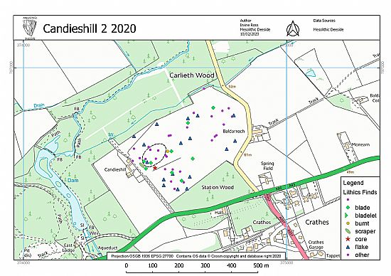
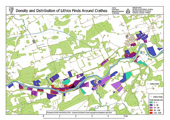
These first maps show the fields walked by the Mesolithic Deeside team in January to April 2020. Each dot indicates the find of one or more flints. It looks as if some of the finds locations are on the river bank or even in the river however the accuracy of our hand held GPS receivers is only to the nearest 10 metres so we know these finds were in fact just inside the field boundary. The classification of lithic types is provisional at present until Ann Clark, our lithics expert, completes her assessments.
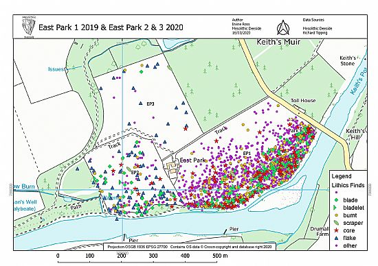
We can now add our information to the data collected in earlier surveys. These include; the excellent work by the Over Fifties Archaeological Research Society (OFARS) in 2008-2011, Sheila Duthie in 2000-2017, Dr Jane Kenney in 1993 and Dr J C Grieve in 1992-1995. It is obvious that the densest scatters are in the fields at Nethermills at Crathes and East Park at Drumoak. The number of find spots makes it hard to distinguish where exactly in the field is the highest concentration.
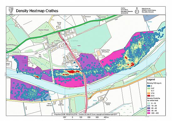
To overcome this problem we can get the computer to generate a density "Heatmap" showing where the really intense concentrations of finds are located. This is the one for Nethermills.
So far we have concentrated on the area around Crathes but what about the wider picture?
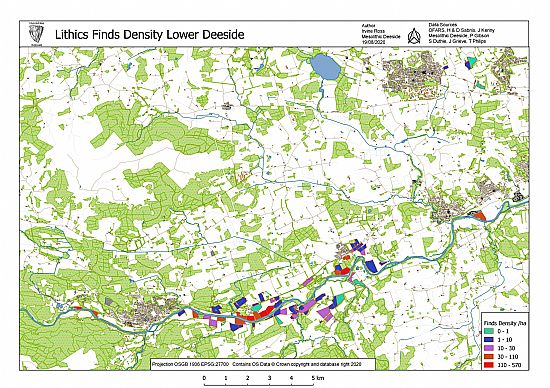
The final map collates information from Fieldwalking by the Over Fifties Archaeological Research Society (OFARS), Sheila Duthie, Dr Jane Kenney, Dr J C Grieve and Mesolithic Deeside.
